Narbethong local newspapers
Local newspapers matching Narbethong
L
- Lilydale & Yarra Valley Leader (Chirnside Park, Coldstream, Healesville, Kalorama, Kilsyth, Launching Place, Lilydale, Millgrove, Monbulk, Montrose, Mooroolbark, Mount Dandenong, Mount Evelyn, Narbethong, Olinda, Powelltown, Seville, Silvan, Tarrawarra, Wandin, Warburton, Wesburn, Woori Yallock, Yarra Glen, Yarra Junction, Yellingbo, Yering)
Narbethong, Victoria
|
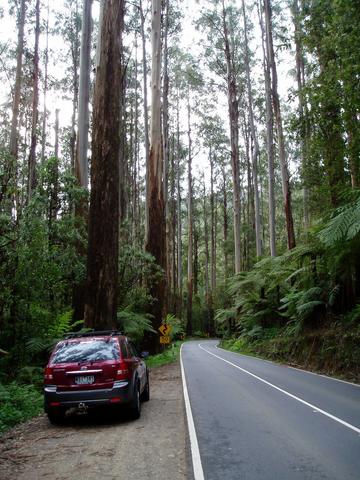
Narbethong Countryside Photo 30/10/2008 Photos and information submitted by Gary Pope, Many Thanks |
Narbethong sits on the northern side of Mt Dom Dom which is at the peak of the Black Spur, up from Fernshaws reserve on the south side valley. Stop off at Mt Dom Dom rest area/picnic area for a view of the surrounding mountainside. The entrance up this magnificent winding stretch of road shows off some of the best parts of the forest with huge Victorian Ash Trees forming an immense towering canopy over the tree ferns below. Little exists of an actual town as such, but the area does boast the fine Black Spur Inn, and a short way further north, is a caravan and camping park with its own general store and fuel stop. Numerous properties have been developed into private Bed'n'Breakfast hideaways, but the weekend action is definitely at the local Pub, as car enthusiasts, motorcyclists and Melbournians pour up through this great area - all seasons! |